Photo Album
Photo of the Day for June 30

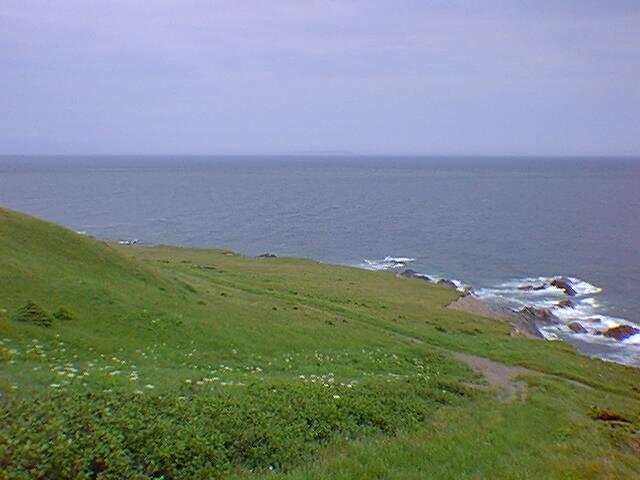
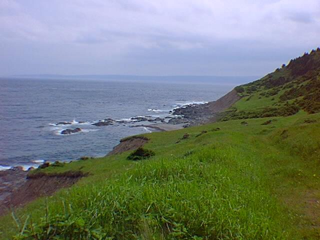
Wow!
Still a few hundred feet above the ocean, the trail opens up to a sloping meadow that ends at cliffs dropping to the rocky shore below.
|
S |
M |
T |
W |
T |
F |
S |
|
June |
19 | 20 | ||||
|
July |
||||||
Moose-Eye View
First mountain climbed, on to the next ridge and along the flat top for what seemed miles.
Overlooking St. Margret's Village, Bay St. Lawrence and Deadman's Pond.

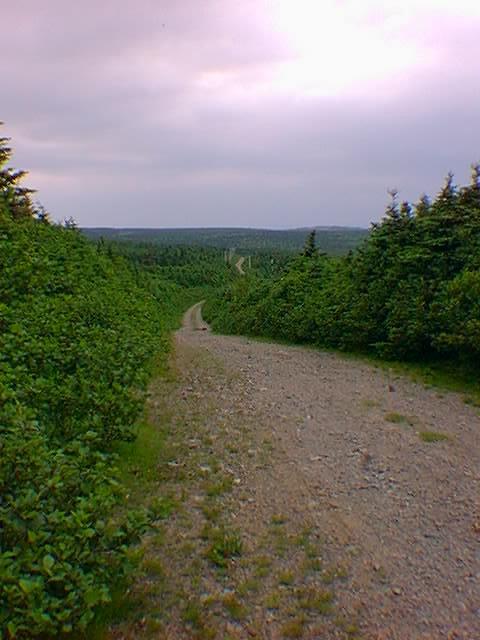
Pass At Your Own Risk
The road across the highlands was in OK shape although most
Miata owners probably wouldn't drive it. By going slow and
watching for ruts and large rocks, we avoided bottoming out.
This was a cake walk compared to yesterday's Red River road.

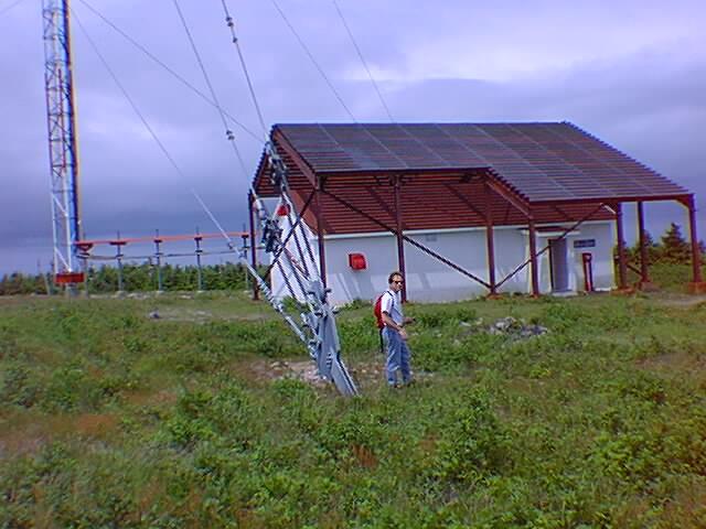
A Large Radio Tower
This is a coast guard tower, the
structure over the radio shack is heavy steel with chainlink
fence covering it - must be to protect the shack from ice falling.
off the tower - Yikes!
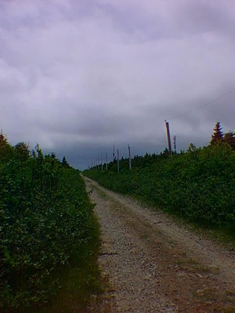
Time To Walk
After the radio towers, the road got too uneven for
the Miata so we hoofed it in another mile and a half.
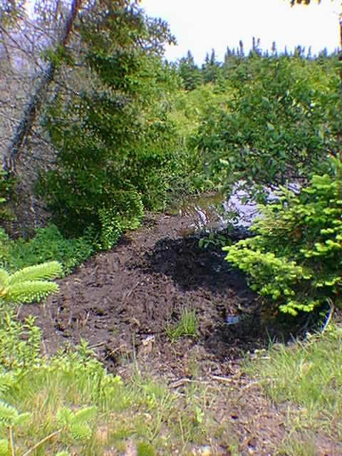
Mud and Moose
The start of our walk was pretty dry, when we began to find evidence of water we also found plenty of trails and tracks- very fresh!
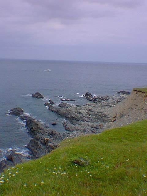
Descent to Money Point and Cape North
The road began to narrow, the haze of blue at the vanishing point is water.. Still not sure this was the way, yet the solitary power line was our hope for what lay before us.

Going Down
This is the start of the steep descent to Money Point.
At this point, the trail drops from 1200+ feet to sea
level in 3/4 of a mile. Some very steep parts with
lots of loose rock. Toe Jammer!

Taking It IN
Rosanne a few feet above as we make the easy slopes of the point. Note the steep hillside behind her. There is only one trail out of here.

Seals Play Here, Ships Wreck Here
Spotted some big brown seals doing rolls and dives.
The last big wreck was in 1975. Money point got its name from
money found on the shoreline after a wreck. High tide kept us from a little treasure hunting.
Fair in Fair Weather
But not where you want to be on a bad day. I'm told this is a popular snowmobile destination. After all most wouldn't consider hiking ALL the way down and back up again.
Will be loyal to the aerobic stair-stepper to train for next year's excursion.

Ominous Clouds, Rugged Terrain and Ocean
It's places like this that keep us coming back. It's a
nice day but there is a sense that it could turn nasty
in a heartbeat.

Lighthouse Lunch
Rosanne is sitting on an old cellar hole that now contains
a helicopter landing pad made of timbers - progress.
The Cape North Lighthouse is automatic now. Mostly viewed by lobster-men and whale-watching tours.s

High to Low
An awe-inducing place to be, you should see this in person. We sure get the feeling we are somewhere else.
Maybe the end of the world- or the start of a new one.

Shouldn't that be Whom?
A little controversy at the end of the world - land that is...

Cape North Whale Watch
The only other people we saw while hiking.
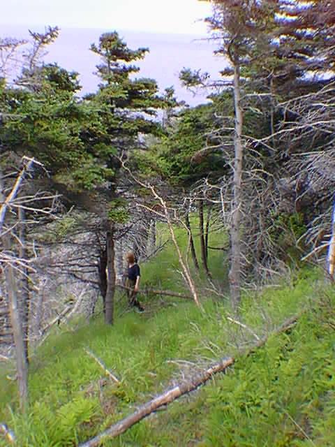
Follow That Moose!
We followed what looked like a moose trail and quickly
found ourselves back on the steep slopes walking
thru thick scrub pine.
Black Bear!
Near Center and toward the top of this photo there really is a black bear.
A thrill for us to watch him cross above us as he foraged for berries or insects.
He even tumbled a rock down toward us.
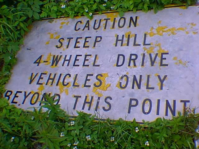
Good Advice
We spotted this downed sign at the top on the way out. Later
on we talked to a local that had actually taken a 4x4 down
the hill and said "it was a nail biter". Not much point
either as there is nowhere to drive once you're down!
Long Walk Back
Access road to car, our feet felt every step.
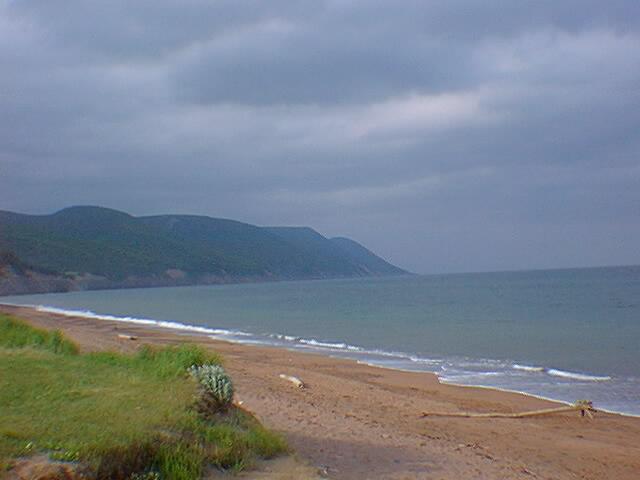
Sandy Dingwall Beaches
We can see our accommodations in the distance. Aspy Bay and it's protective dunes and sandbars.

Different Weather Over There
That's where we're headed. Looks like it's time to go!

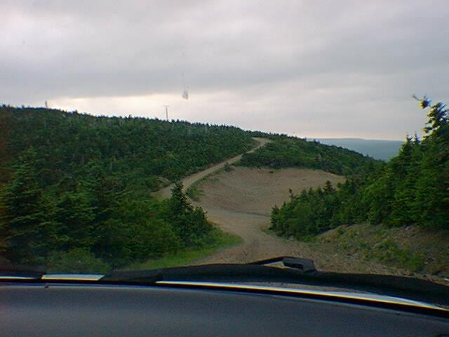
Steeper Than It Looks
The worst section of road to the hike was the climb up
to the highlands. I envisioned coaxing my Miata out of here
in the midst of a torrential downpour and thanked the
weather gods for sparing us.
Cabot's Landing
We concur, 'tis a fine place to land, although they had
to cook for themselves.
Remember "the Matthew" from last year's trip? This is where it landed to discover the "New World"
And that last lump of land to the right, that's where we just came from.
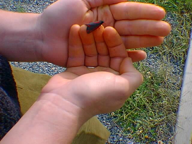
An Insect Treat
A new and unusual butterfly (for us New Englanders). Mostly
black with striking red patterns. We hope this is not the
adult of the catapillar that's destroying the pulpwood!